Plenty of travelers book Curaçao before they could point to it on a map, and the island forgives them instantly. But knowing where you are going makes the trip better, because Curaçao's location is not a trivia answer. It is the reason the weather behaves, the reason four languages share the sidewalk, and the reason your first morning here feels suspiciously free of jet lag.
So, the geography lesson, kept painless.
I.The short answer
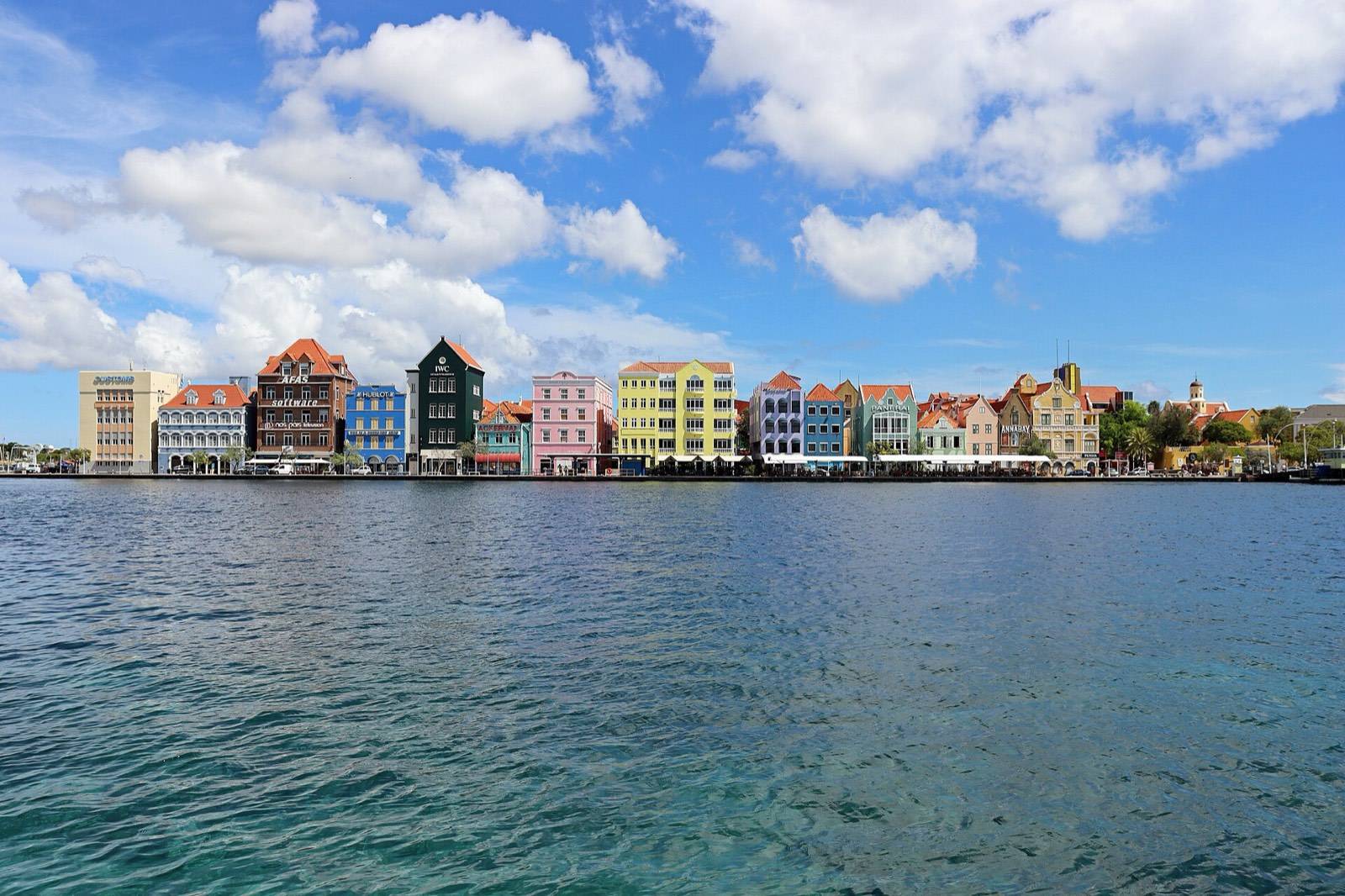
Curaçao lies in the far southern Caribbean, about 40 miles north of the Venezuelan coast, at roughly twelve degrees north of the equator. It is the middle island of the ABC chain, with Aruba to the west and Bonaire to the east, and it belongs to the Dutch Caribbean. The capital, Willemstad, is a UNESCO World Heritage city on the island's sheltered southern coast.
That single sentence carries a lot of consequences, and the rest of this page unpacks them.
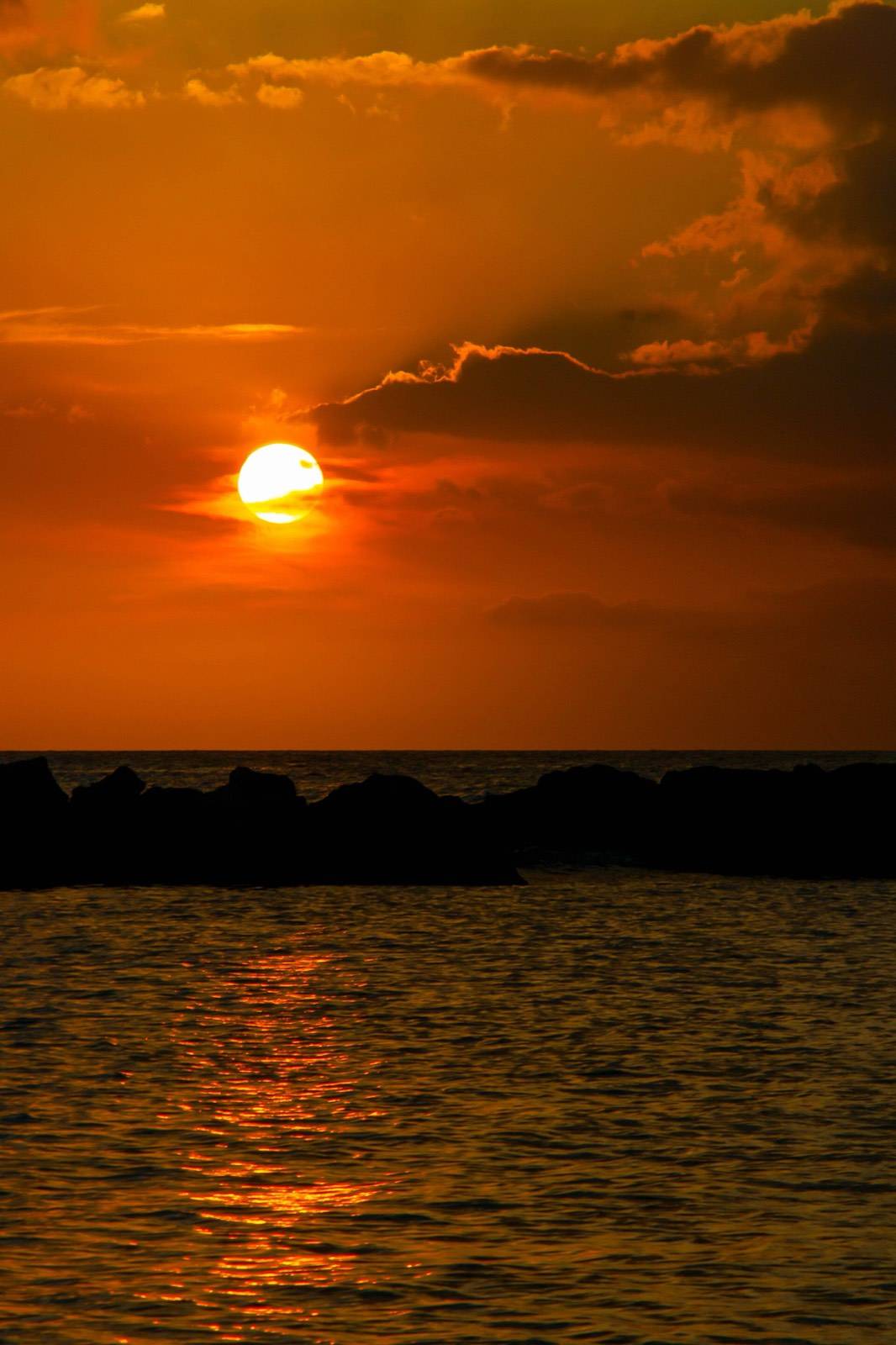
The island sits so far south that the Caribbean's famous storm track passes high overhead, year after year, like weather happening to someone else.
II.The ABC islands, west to east
Sail the last arc of islands before South America and you read them alphabetically: Aruba, then Curaçao, then Bonaire. The three share Dutch heritage, trade winds, and dry, cactus-studded landscapes, yet they divide travelers neatly. Aruba built itself around big resorts and a long famous beach. Bonaire gave itself to divers. Curaçao, the largest of the three, kept a real city, a working culture, and a coastline of separate coves rather than one continuous strip.
If you are weighing them against each other, our three-island comparison settles the question persona by persona. The short version: travelers who want history, food, and beaches in the same day tend to land here.
III.A country within the Kingdom of the Netherlands
Curaçao is not a territory or a province. It is a constituent country within the Kingdom of the Netherlands, with its own government, its own currency (the Antillean guilder, pegged at 1.79 to the US dollar, though dollars are accepted nearly everywhere), and its own cultural identity centuries in the making. Punda, the historic heart of Willemstad, was founded by the Dutch in 1634, and the historic center earned its UNESCO inscription in 1997.
The Dutch thread is visible everywhere: the gabled facades along the harbor, the language of the courts and classrooms, the cheese in the bakeries. But the island speaks with its own voice, in a mother tongue all its own. The full story lives in our guide to what language is spoken in Curaçao.
IV.The time zone is refreshingly simple
Curaçao keeps Atlantic Standard Time every week of the year. There is no daylight saving change, ever. For travelers from the US East Coast the math is friendly: in summer the island's clocks match US Eastern time exactly, and in winter the island runs one hour ahead of New York. European visitors land into an afternoon that feels like a long, generous evening.
V.How long does it take to get here?
Think in gentle ranges rather than timetables. From Miami the flight runs about three hours. From New York and the US Northeast, plan on roughly five. From Amsterdam, the long-haul link to the Kingdom, expect nine to ten hours in the air. Nonstop service operates from several North American and European hubs, and one-stop connections through the usual gateways cover nearly everywhere else. Routes and frequencies shift with the seasons, so check schedules close to booking.
You will arrive at Hato International Airport, code CUR, on the island's north side, a short drive from Willemstad and the hotels of the historic center. Entry paperwork is light for most nationalities; the specifics are in our entry requirements guide.
VI.What twelve degrees north feels like
Here is where geography turns into vacation. Twelve degrees north puts Curaçao below the main hurricane belt, so the storm anxiety that shadows planning elsewhere in the Caribbean mostly does not apply. The same latitude delivers steady trade winds, low rainfall, and air that holds the 80s°F all year, with the sea near 80°F to match. The numbers month by month are in our weather reference.
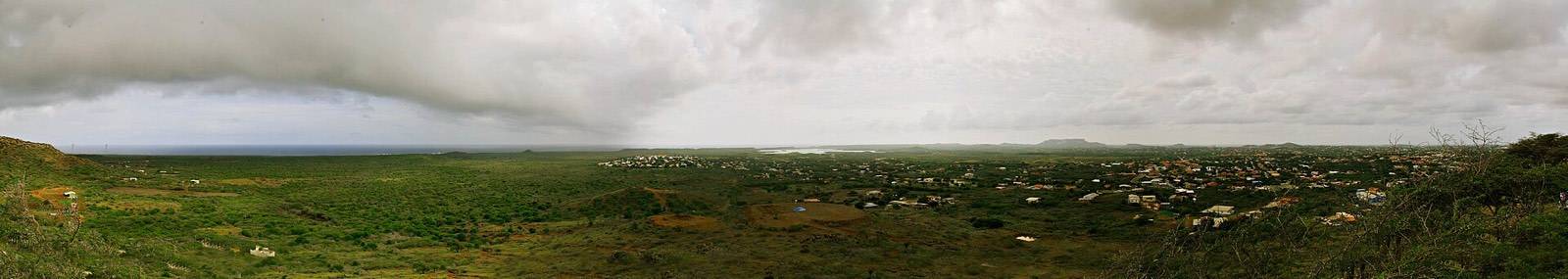
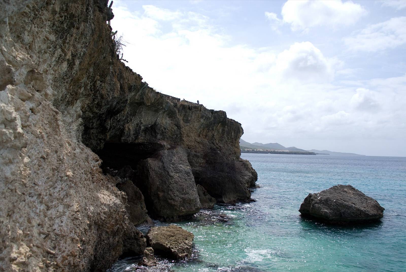
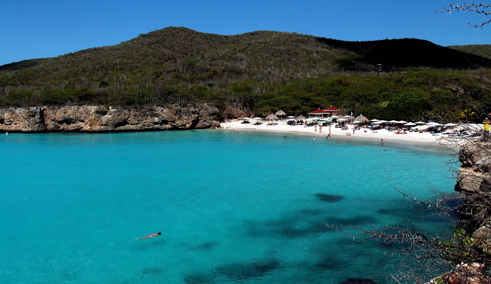
The island's shape completes the trick. Curaçao lies long and slender, angled with the wind, so its southern and western shores sit in the lee: calm, clear, and dotted with the coves the postcards love. The north coast takes the ocean's full force and answers with blowholes and wave-carved cliffs. One island, two personalities, forty minutes apart by car.
VII.Once you land: the lay of the island
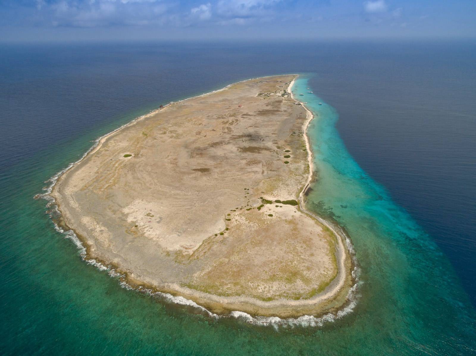
Curaçao runs about 38 miles end to end, which means nothing on it is truly far. Willemstad anchors the southern coast: Punda and Otrobanda facing each other across the harbor mouth, Pietermaai and Scharloo at their shoulders, all of it walkable from our door in Otrobanda. The west end holds the famous swimming coves and both national parks. The southeast holds Jan Thiel, the Mambo Beach strip, and the sailing waters of Spanish Water. Offshore to the southeast lies Klein Curaçao, the uninhabited islet with the lighthouse, about two hours away by boat.
A first trip clicks together easily from that map: city days in the middle, beach days to the west, a boat day offshore. If that sounds like a plan, it nearly is one; our three-day itinerary turns it into hours and turns the hours into a holiday.
Now you can point to it on the map: the last arc of the Caribbean, the middle island, the one with the city. Kòrsou, as it calls itself. Closer than you think, calmer than you hoped.
Questions travelers ask
Straight answers from the front desk.
What country does Curaçao belong to?
Is Curaçao part of the ABC islands?
How far is Curaçao from Venezuela?
What time zone is Curaçao in?
How long is the flight to Curaçao?
Keep exploring
Curaçao entry requirements: what you actually need to visit
Curaçao entry requirements made simple: passport validity, the digital immigration card, proof of return…
The best time to visit Curaçao: an honest month-by-month guide
When is the best time to visit Curaçao? A month-by-month local guide to seasons, crowds, prices and Carnival…
Curaçao vs Aruba: an honest comparison from people who chose one
Curaçao vs Aruba, compared honestly: beaches, culture, nightlife, costs, crowds, and weather, plus a clear…
A restored 1892 monument, steps from everything in this guide.
Eighteen boutique rooms across five categories on Breedestraat, Punda. Signature balconies over the main street, and the Van Gogh café pouring espresso downstairs. Reserve your room on Airbnb in a few taps.