Willemstad is one of the few World Heritage cities in the Caribbean that you can read in full on foot in a single morning. The historic center is flat, compact and arranged around one photogenic stretch of water, and the famous bridge stitches its two halves together at exactly walking pace.
This is the loop we draw on paper for guests at the front desk, polished into eleven numbered stops. It starts on our bank, in Otrobanda, but it is a circle: join it anywhere, walk it in either direction, and finish where the light is.
I.Before you set out
Two rules make the whole route better. First, timing: start by eight in the morning or after three in the afternoon. The loop has no hills, but it also has very little shade between the highlights, and the difference between walking Willemstad at nine and at noon is the difference between a stroll and an endurance event. The light rewards the early and the late as much as the temperature does.
Second, equipment: flat soles for cobbles, water, a hat, and sun protection. Leave the agenda loose. The route takes about two and a half hours unhurried, but the city is good at inventing reasons to stop.
II.The loop at a glance
| Stop | Place | Bank | Unhurried time |
|---|---|---|---|
| 1 | Rif Fort ramparts | Otrobanda | 15 min |
| 2 | The alleys and werfs | Otrobanda | 20 min |
| 3 | Queen Emma Bridge crossing | Over the bay | 10 min |
| 4 | Handelskade waterfront | Punda | 15 min |
| 5 | Breedestraat and Heerenstraat | Punda | 15 min |
| 6 | Gomezplein | Punda | 10 min |
| 7 | Mikvé Israel-Emanuel synagogue | Punda | 20 min |
| 8 | Floating Market | Punda | 10 min |
| 9 | Plasa Bieu | Punda | 15 min, or 45 with lunch |
| 10 | Pietermaai extension (optional) | East of Punda | 30 min |
| 11 | Recross the bridge at dusk | Over the bay | 10 min |
Core route: roughly two and a half hours with transitions. Lunch and Pietermaai turn it into a leisurely half day.
III.Stops 1 to 3: our bank, then the crossing
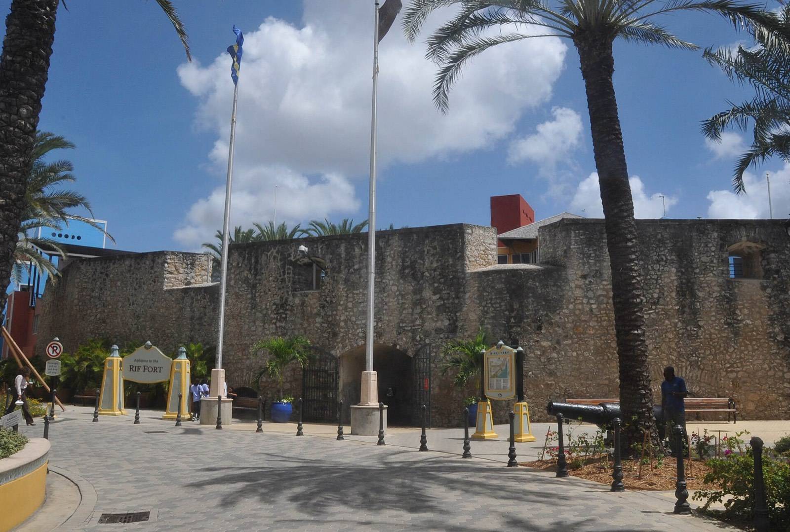
Stop 1, Rif Fort. Begin at the harbor mouth, where the squat stone fort has guarded the channel for the better part of two centuries. Climb to the ramparts for the opening shot of the day: open sea, the channel below, and the whole route laid out across the water.
Stop 2, the alleys and werfs. Drift inland through Otrobanda's unplanned lanes and inner courtyards. This quarter accreted rather than being designed, and ten minutes of wrong turns here teach you more than any plaque. Keep an eye on the walls: the murals begin almost immediately, and the dedicated route through them lives in our street art guide.
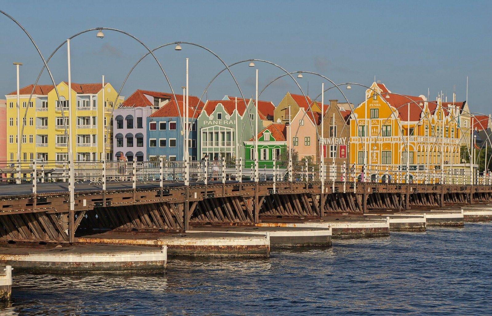
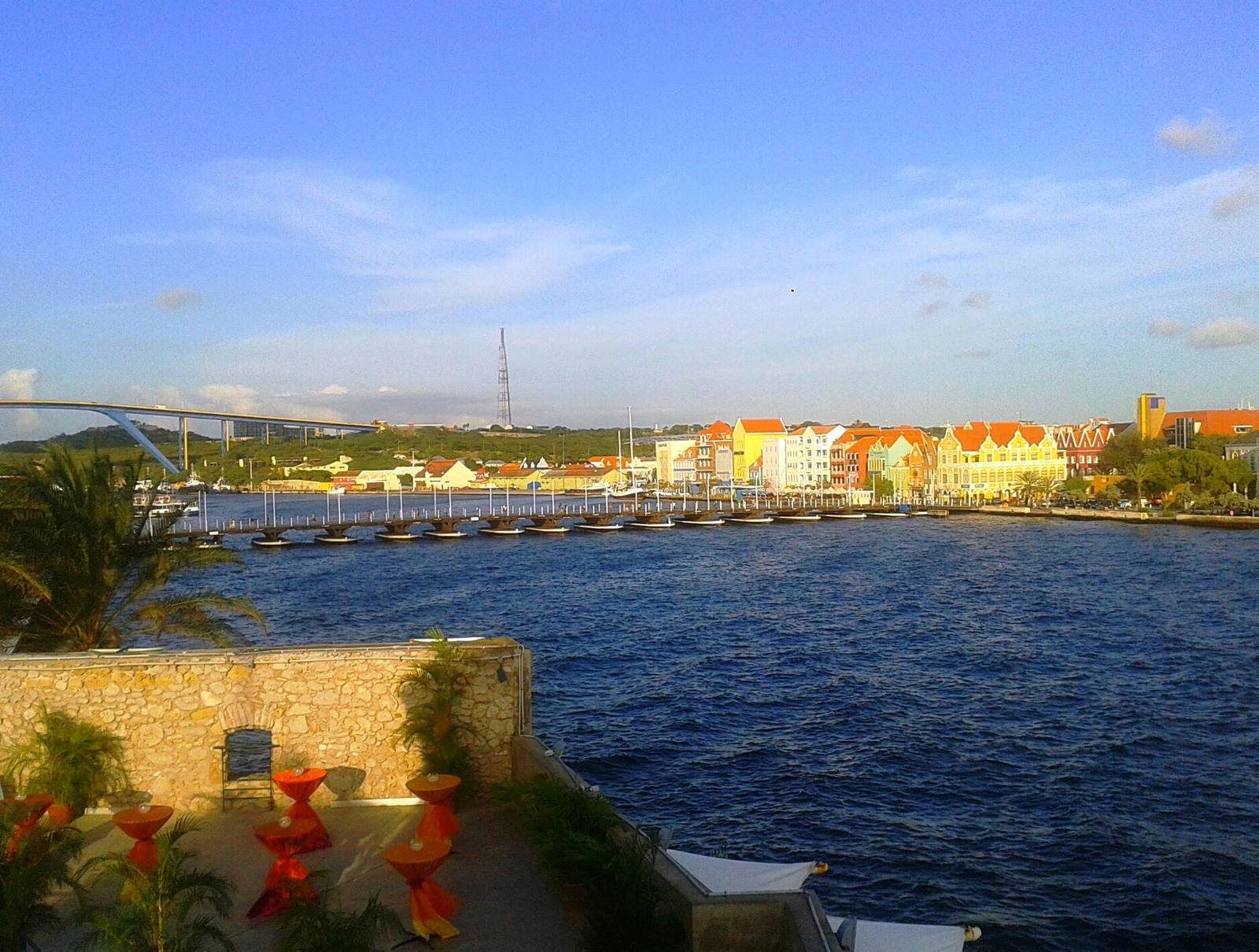
Stop 3, the bridge. Cross the Queen Emma Bridge, the floating pontoon walkway that has carried this city across St. Anna Bay since 1888. Pause mid-span; the deck hums underfoot and both banks present themselves at once. If the bridge swings open for a ship, the free ferry takes over from the docks beside the bridge feet.
IV.Stops 4 to 6: the waterfront and the lanes
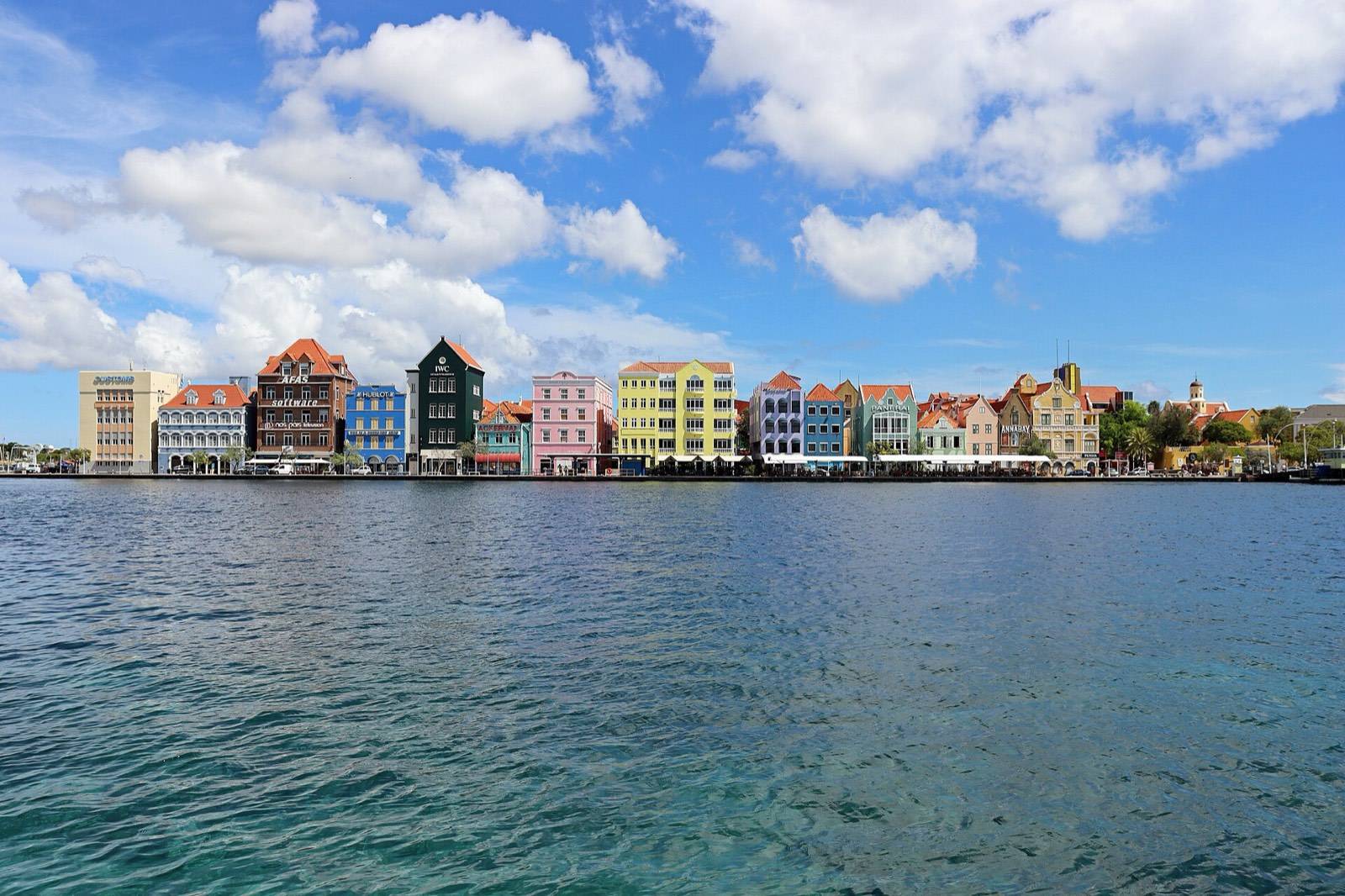
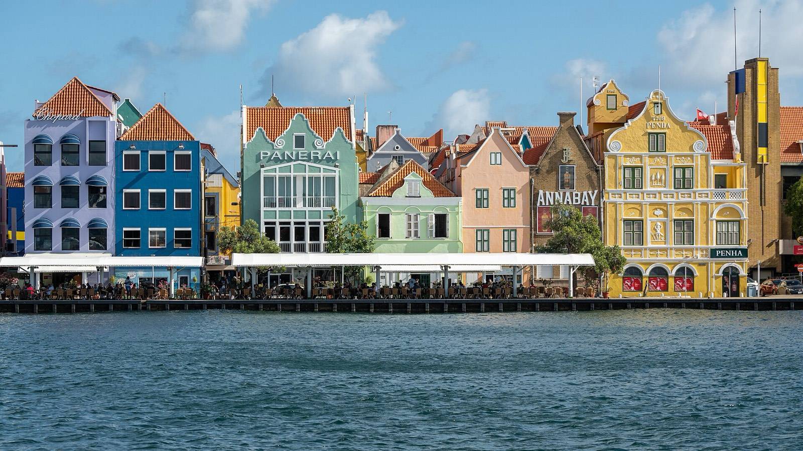
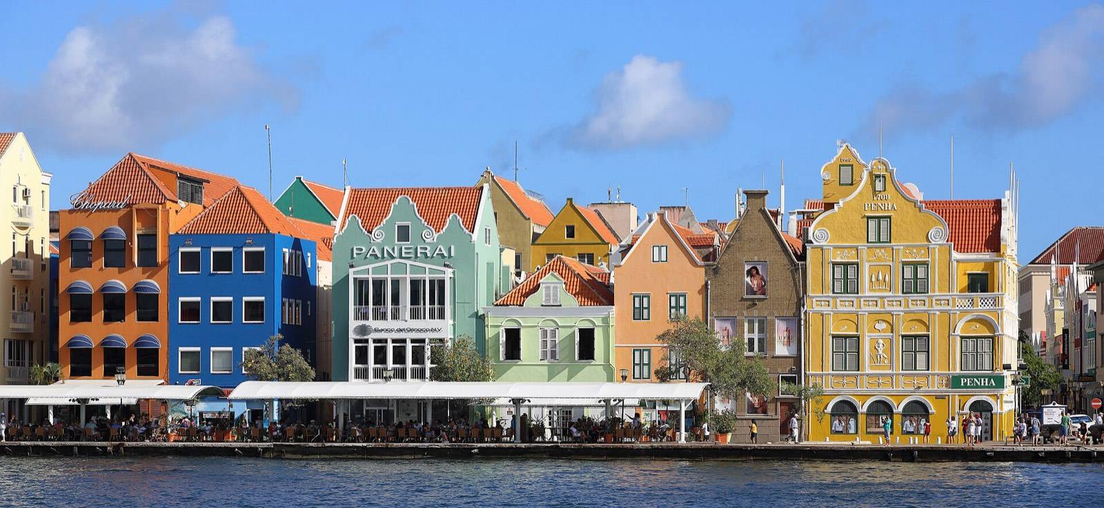
Stop 4, the Handelskade. Step off the bridge and turn to face the row you crossed for. The gabled facades of Punda's waterfront are the island's signature image, and the arcades beneath them hold cafe tables built for exactly this pause.
Stop 5, Breedestraat and Heerenstraat. Walk the shopping spine and its parallel lane. The architecture above the shopfronts outclasses most of what is in the windows, though the genuinely worthwhile purchases are sorted in our Punda shopping guide.
Stop 6, Gomezplein. The shaded square where the grid exhales. Benches, buskers and the best people-watching corner in the quarter. Sit for ten minutes; this is a tour, not a march.
V.Stops 7 to 9: sand floors, market boats and lunch
Stop 7, the synagogue. Mikvé Israel-Emanuel is the oldest synagogue in continuous use in the Americas, its building consecrated in 1732 and its floor kept in sand by tradition. Dress modestly; a small admission supports the building, and the hush inside is worth double it. Confirm visiting times locally.
Stop 8, the Floating Market. At the north edge of the grid, Venezuelan boats moor against the quay to sell fruit and produce, as they have for generations. Mornings show the market at its fullest.
Stop 9, Plasa Bieu. The old covered market hall is the route's natural lunch: stoba, fresh catch and funchi from long-simmering pots, eaten at shared tables. Go before the pots empty. The full eating map of the city is in where to eat in Willemstad.
VI.Stop 10: the Pietermaai extension
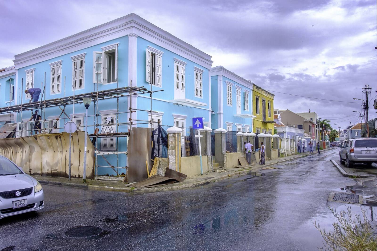
If the legs vote yes, continue ten minutes east into Pietermaai, the third UNESCO quarter, where restored townhouses in sun-bleached pastels now hold cafes, small hotels and the city's dinner row, with the open sea breaking just behind them. Half an hour covers the main street and the ocean side.
The honest alternative: skip it now and return for dinner. Pietermaai is at its best after dark, and this loop is at its best before the heat.
VII.Stop 11: recross at dusk
However you spend the afternoon, arrange to be back at the bridge for golden hour. The lamps come on along the Handelskade, the bridge's arcs light up over the water, and the crossing you made at stop 3 becomes a completely different scene. Finish on Brionplein with the evening crowd, or back up on the fort ramparts where you started, watching the city switch itself on.
A city this compact should not hold this much. Walking is the only speed at which Willemstad adds up.
If one loop leaves you wanting the long version, our one day in Willemstad stretches this route from dawn to dark, with both banks given the hours they deserve.
Questions travelers ask
Straight answers from the front desk.
How long does the Willemstad walking tour take?
Should I walk Willemstad in the morning or afternoon?
Is Willemstad easy to explore on foot?
Do I need a guide for Willemstad?
What happens if the Queen Emma Bridge opens mid-route?
Keep exploring
One day in Willemstad: a dawn-to-dark loop of the UNESCO city
One day in Willemstad, dawn to dark: golden hour on the Handelskade, Punda lanes and markets, bridge…
Things to do in Otrobanda: our side of the bridge
Things to do in Otrobanda, Willemstad: Rif Fort ramparts, hidden alleys and werfs, world-class street art and…
Things to do in Punda: the painted heart of Willemstad
The best things to do in Punda, Willemstad: the Handelskade at first light, a sand-floored synagogue, the…
A restored 1892 monument, steps from everything in this guide.
Eighteen boutique rooms across five categories on Breedestraat, Punda. Signature balconies over the main street, and the Van Gogh café pouring espresso downstairs. Reserve your room on Airbnb in a few taps.